Data Acquisition and Management
Acquiring Geospatial Datasets
We can use different geospatial technologies to acquire (or collect) spatial and non-spatial data from the Earth’s surface. Today, geospatial technologies are enabling local citizens to become more involved in collecting and/or analyzing geographic data. Researchers and other individuals can make good use of spatial and non-spatial data collected by others; these types of data are typically referred to as “open-source” data because they are openly available for anyone to use at no cost.In today’s digital age, there are a variety of sources where one may find open-source geospatial datasets from crowd-sourced data and citizen science (community engagement!), to Scholars Geoportal and federal/provincial/regional/municipal open-data portals. One excellent online example of community-based/crowd-sourced data is Geospatial Niagara’s treeOcode data.
While crowd-sourced information can be very useful, especially in circumstances where many people can report flood conditions within a city on their smartphones, there are some challenges with these data. Challenges can include:
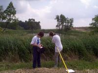
In many geospatial research contexts, additional equipment is often used to collect geospatial datasets. For example, in situ hand-held devices (such as an imaging spectroradiometer) can be used to collect information about the reflectance/emission characteristics of Earth surface features (e.g., the spectral reflectance from a plant leaf in an upland wetland area).
- Accessibility of the data: one challenge to environmental sustainability concerns is the issue of data sharing.
- Physical infrastructure: some people or organizations simply do not have the ability to download or store data on a local computer/server.
- Reliability of data.
Remote sensing data are typically acquired from different distances from the Earth’s surface. However, measurements can be acquired from the ground (called in situ measurements; approximately 1-2 m from the object of interest), from the air (by aircraft or a drone at a few hundred feet from the object of interest) or from space (typically 500-600 km above the Earth’s surface).
Examples of other devices used to collect geospatial datasets include global positioning systems (GPS) and unmanned aviation vehicles (UAVs).
UAVs are increasingly being used to acquire remotely sensed data. UAVs can be equipped with a variety of sensor types specific to the tasks of the user. The most common sensor is a standard camera, which can provide high-resolution imagery of a given area. Like many spaceborne and other airborne remote sensing platforms, UAVs can be used in conjunction with more complicated and active sensors (e.g., multispectral and LiDAR). For example a Sequoia multisensor camera provides users with blue, green, red, and near infrared (NIR), data. These bands can be useful for several practical applications, including vegetation and soil moisture monitoring.
Metadata
When collecting your own data or using someone else’s data, it is important to create or acquire a metadata file. A metadata file contains descriptive information about geospatial datasets. For example, a file typically includes:- file naming convention
- data acquisition date and time
- geographic coverage
- data format
- projection information
- For remote-sensing data, the metadata file also contains the following pieces of information:
- name of sensor and platform
- percent cloud cover at the time of image acquisition
- any other data quality measurements
Managing Geospatial Datasets
1. Exploration of the data's metadata file
2. Qualitative and quantitative assessments, which can be used to determine the quality of the data.
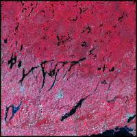
- Qualitative assessments: Visual interpretation of the data. Are there any obvious visual anomalies in the data? In the figure to the right, visual assessment of the imagery reveals cloud cover in the middle portion of the image scene.
- Quantitative assessments: Review statistics on a band-by-band basis